Property Record
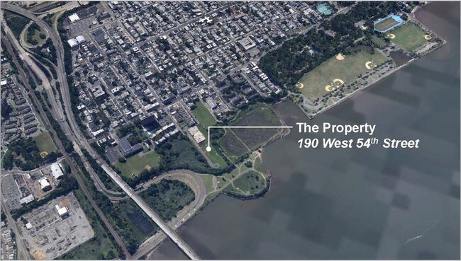
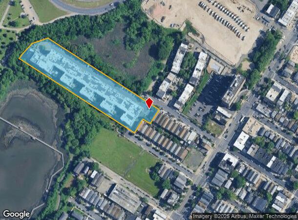
190 W 54Th St, Bayonne, NJ 07002
NEARBY LISTINGS FOR SALE OR LEASE
Property Detail
190 W 54Th St
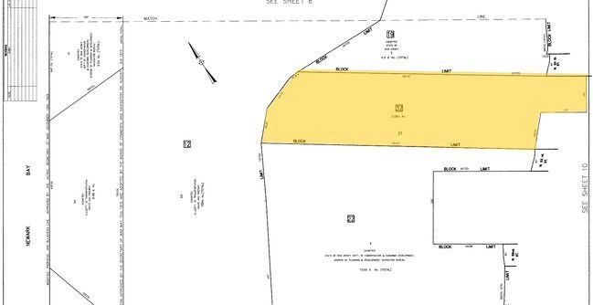
01-00032-0000-00021-01
Hudson
Vacantlandnec
New Jersey
X
21.1
34013C0178F
3.79 AC
2024
Hudson Waterfront
2025
Northern New Jersey
010100
New York-Jersey City-White Plains, NY-NJ
DEMOGRAPHICS near 190 W 54Th St
1 Mile
3 Mile
5 Mile
2024 Total Population
28,557
154,698
578,467
2029 Population
27,049
146,574
561,997
Pop Growth 2024-2029
(5.28%)
(5.25%)
(2.85%)
Average Age
40
39
37
2024 Total Households
10,424
55,937
223,315
HH Growth 2024-2029
(5.90%)
(5.84%)
(2.90%)
Median Household Inc
$69,609
$65,148
$71,150
Avg Household Size
2.60
2.60
2.50
2024 Avg HH Vehicles
1.00
1.00
1.00
Median Home Value
$389,905
$383,923
$471,753
Median Year Built
1960
1958
1968
Nearby Places
- Restaurants
- Banks
- Shops
- Fitness
- Groceries
PUBLIC TRANSPORTATION
TRANSIT/SUBWAY
45Th Street (22nd Street-Hoboken Terminal - Hudson-Bergen Light Rail (Hudson-Bergen Light Rail))
DRIVE
WALK
Distance
45Th Street (22nd Street-Hoboken Terminal - Hudson-Bergen Light Rail (Hudson-Bergen Light Rail))
3 min
20 min
1.1 mi
COMMUTER RAIL
Journal Square (Journal Square-33rd Street - Port Authority Trans-Hudson (PATH), Newark Penn Station-World Trade Center - Port Authority Trans-Hudson (PATH))
DRIVE
WALK
Distance
Journal Square (Journal Square-33rd Street - Port Authority Trans-Hudson (PATH), Newark Penn Station-World Trade Center - Port Authority Trans-Hudson (PATH))
9 min
4.1 mi
St George (Staten Island Railway - New York MTA Subway (The Subway))
DRIVE
WALK
Distance
St George (Staten Island Railway - New York MTA Subway (The Subway))
23 min
9.9 mi
AIRPORT
Newark Liberty International
DRIVE
WALK
Distance
Newark Liberty International
9 min
5.9 mi
LaGuardia
DRIVE
WALK
Distance
LaGuardia
36 min
18.2 mi
John F Kennedy International
DRIVE
WALK
Distance
John F Kennedy International
45 min
26.4 mi
Freight Ports
GCT Bayonne
DRIVE
WALK
Distance
GCT Bayonne
9 min
3.0 mi
Nearby Properties
Address
Land Use
TOTAL SIZE
Lot Size
Zoning
Address
Land Use
TOTAL SIZE
Lot Size
Zoning
961.13 AC
Address
Land Use
TOTAL SIZE
Lot Size
Zoning
229.72 AC
Address
Land Use
TOTAL SIZE
Lot Size
Zoning
98.48 AC
Address
Land Use
TOTAL SIZE
Lot Size
Zoning
131.26 AC
Address
Land Use
TOTAL SIZE
Lot Size
Zoning
4.51 AC
Address
Land Use
TOTAL SIZE
Lot Size
Zoning
Address
Land Use
TOTAL SIZE
Lot Size
Zoning
1.15 AC
Address
Land Use
TOTAL SIZE
Lot Size
Zoning
19.03 AC
Address
Land Use
TOTAL SIZE
Lot Size
Zoning
Address
Land Use
TOTAL SIZE
Lot Size
Zoning
216 AC
Address
Land Use
TOTAL SIZE
Lot Size
Zoning
22.49 AC
HC
Address
Land Use
TOTAL SIZE
Lot Size
Zoning
Address
Land Use
TOTAL SIZE
Lot Size
Zoning
Address
Land Use
TOTAL SIZE
Lot Size
Zoning
75.51 AC
Address
Land Use
TOTAL SIZE
Lot Size
Zoning
69.45 AC
Address
Land Use
TOTAL SIZE
Lot Size
Zoning
1.01 AC
Address
Land Use
TOTAL SIZE
Lot Size
Zoning
108.75 AC
Address
Land Use
TOTAL SIZE
Lot Size
Zoning
710 SF
39.32 AC
Address
Land Use
TOTAL SIZE
Lot Size
Zoning
63.35 AC
Address
Land Use
TOTAL SIZE
Lot Size
Zoning
2.54 AC
Address
Land Use
TOTAL SIZE
Lot Size
Zoning
12.50 AC
Address
Land Use
TOTAL SIZE
Lot Size
Zoning
30.92 AC
Address
Land Use
TOTAL SIZE
Lot Size
Zoning
3.27 AC
Address
Land Use
TOTAL SIZE
Lot Size
Zoning
17.60 AC
Address
Land Use
TOTAL SIZE
Lot Size
Zoning
Address
Land Use
TOTAL SIZE
Lot Size
Zoning
28.47 AC
I-H
Address
Land Use
TOTAL SIZE
Lot Size
Zoning
114.66 AC
BMHO
Address
Land Use
TOTAL SIZE
Lot Size
Zoning
89.40 AC
R1
Address
Land Use
TOTAL SIZE
Lot Size
Zoning
29.10 AC
Address
Land Use
TOTAL SIZE
Lot Size
Zoning
115.33 AC
IH
The World's #1 Commercial Real Estate Marketplace
Connect with us
© 2025 CoStar Group
The information above has been obtained from sources believed reliable. While we do not doubt its accuracy we have not verified it and make no guarantee, warranty or representation about it. It is your responsibility to independently confirm its accuracy and completeness. Any projections, opinions, assumptions, or estimates used are for example only and do not represent the current or future performance of the property. The value of this transaction to you depends on tax and other factors which should be evaluated by your tax, financial, and legal advisors. You and your advisors should conduct a careful, independent investigation of the property to determine to your satisfaction the suitability of the property for your needs.